Kochi Prefecture
The Shimanto River and its sinking bridges
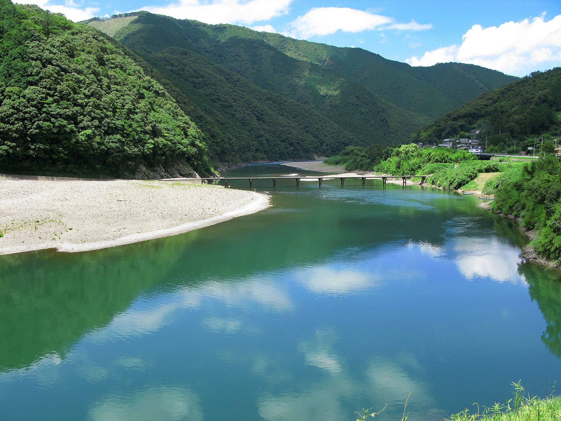
Shikoku's longest river winds slowly through forested hills to the Pacific, crossed by low bridges without railings and lined with gravel bars where you can sleep beside the water.
- Best months
- Late April to May, October
- Getting there
- Train to Kubokawa or Nakamura, then car
- Pack
- Sun hat, sandals, mosquito coils, plenty of water
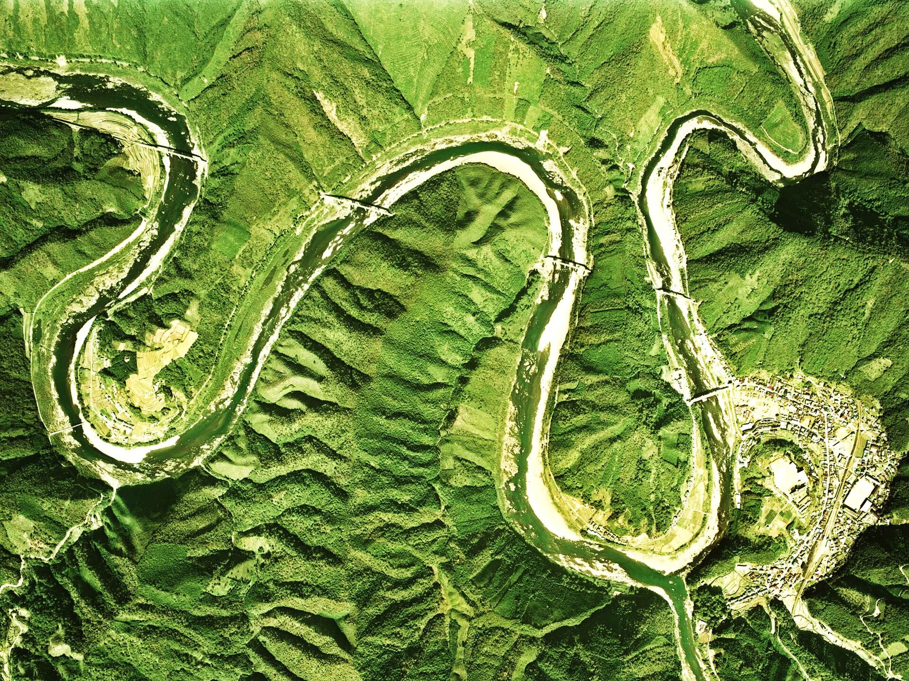
The Shimanto River rises in the mountains of western Kochi Prefecture and takes a long, looping route through the hills before reaching the Pacific at Shimanto City. It is the longest river in Shikoku, and it is often called Japan's last clear stream. That phrase is part description and part hope: what makes the Shimanto special is less the clarity of its water on any one day than the way the whole river still feels lived with rather than engineered.
Concrete embankments are rare along much of its course. Villages sit on terraces above the water, fishermen still work it for ayu (sweetfish) and river prawns, and in place of high road bridges, many crossings are low, plain concrete slabs that let floods wash over them. For a camper, it means gravel bars, slow green pools, and long evenings beside the water listening to frogs.
The chinkabashi, bridges built to sink
The Shimanto's best-known feature is its chinkabashi, literally "sinking bridges". They are narrow concrete bridges built just above normal water level, with no railings at all. When the river floods after heavy rain, the water rises over the deck and simply flows across. Railings would catch driftwood and branches and tear the bridge apart; without them, the flood passes and the bridge is still there when the water drops.
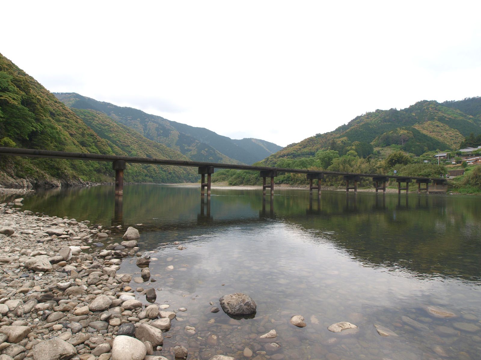
There are dozens of them across the river and its tributaries, and many are still part of daily life, used by local cars, farm trucks and school children. Drive across them slowly, keep to the middle, and give way to local traffic; the decks are only one car wide and the edges are unprotected. Never cross one when the river is high or when it has been closed. Photographers like to stop on them, but they are working roads, so park off the bridge, not on it.
The bridge at Sada, close to Shimanto City, is one of the longest and easiest to reach, with a wide gravel bar beside it. Others are scattered upstream through the valley, and finding them is a good excuse for a slow drive along the river roads. Each one is a little different: some are long and straight across a wide pool, others short and curved around a bend, a few set below steep forested banks where the light stays green all day. Local people treat them as ordinary roads, and the best way to enjoy them is the same way, without fuss.
Camping by the water
Camping along the Shimanto ranges from organised campgrounds to simple riverside grounds kept by the local municipality, many of them on the gravel bars and terraces along the middle and lower river. Some have showers and cabins; others offer little more than a toilet, a tap and a flat place to pitch. Facilities, seasons and fees vary and change, so check with the local tourist office before you go, especially for summer weekends.
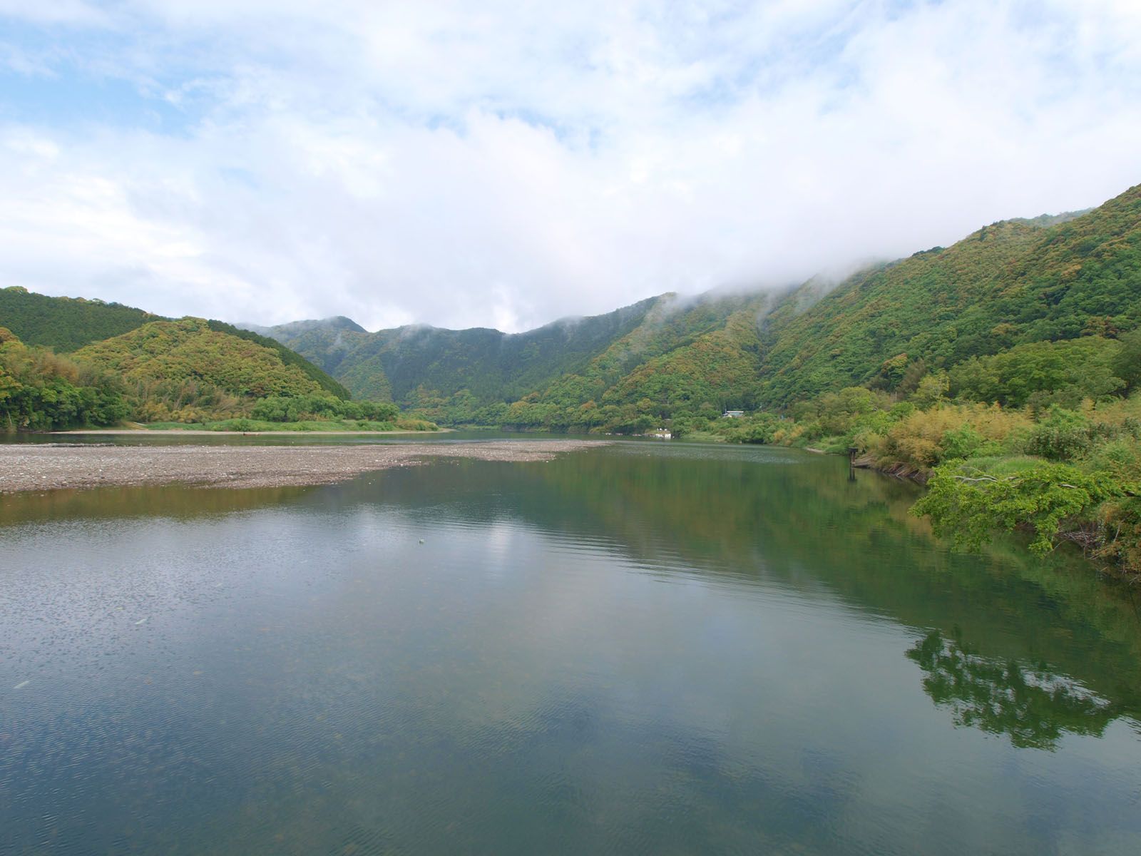
Wherever you stay, the rules are the familiar ones. Fires belong in a fire stand, never directly on the gravel. Sort rubbish exactly as the site asks, or take it home; small villages have limited collection, and litter on a gravel bar ends up in the river at the next flood. The guide to the kinds of campground and their rules explains the difference between a staffed site and a simple municipal ground. Do not camp on gravel bars outside designated grounds.
Above all, pitch with the river in mind. A gravel bar that looks wide and dry can be under water within hours if heavy rain falls upstream, even when the sky above you is clear.
 another page in the bookCamping through the rainy season
Canoes, swimming and the river's food
The Shimanto is one of Japan's favourite rivers for canoeing. Long, slow stretches between gentle rapids make it suitable for beginners, and canoe hire and guided trips are available in season along the middle and lower river. Paddling past the sinking bridges, often passing under one where it is safe, is the classic way to see the valley. Wear a buoyancy aid, check the water level before you launch, and get off the river if it starts to rise or turn brown.
Swimming is popular in summer at the shallow, slow places beside the gravel bars. Currents can be stronger than they look in the deeper channels, and children should be watched closely. Some stretches have fishing rules, and ayu fishing in particular needs a permit in season.
The river's food is reason enough to come. Grilled ayu, river prawns and aonori, the bright green river seaweed harvested near the river mouth in winter, appear at roadside stands and village restaurants. Buy local when you can, and enjoy them by the water. Small roadside stations along the main roads sell vegetables, citrus, rice and river fish from the valley, and they are the easiest place to stock up between campgrounds.
Heat, rain and the safety basics
Western Kochi is warm, humid and wet. Tsuyu, the rainy season, usually arrives in late May or June and lasts into July. High summer brings strong sun, heat that stays high at night, and sudden afternoon storms. From late summer into autumn, typhoons can sweep in from the Pacific, bringing heavy rain and fast-rising rivers.
Watch the weather upstream as well as overhead, check river warnings, and move to high ground at once if the water level rises or the current turns muddy. On the Shimanto, the river decides when you leave, not the forecast for where you are standing.
On the Shimanto, the river decides when you leave, not the forecast for where you are standing.
If a typhoon is forecast, cancel or leave early.For the heat, drink more than you think you need, rest in the shade in the afternoon, and wear a hat. Mosquitoes and gnats are common, and ticks live in the long grass beside the river, so cover your legs and check yourself each evening. Mamushi pit vipers live in the area; watch where you put your hands and feet in rocks and long grass. Asian black bears on Shikoku are very rare and largely confined to the mountains in the east of the island, but hornets are a real summer risk: move away calmly if they circle you.
When to go and how to get there
Spring, from late April to May, brings fresh green hills, comfortable days and fewer insects. October and early November are the other good window, with clear skies, warm days and cool nights. Summer is busiest, with the river at its most inviting for swimming, but also at its hottest. Fireflies dance along quiet tributaries in early summer; the page on fireflies on campground streams tells you how to watch without disturbing them.
From Kochi city, trains run west to Kubokawa and on to Nakamura in Shimanto City, the main town at the lower end of the river. The JR Yodo Line follows part of the middle river from Kubokawa toward Uwajima in Ehime, and makes a slow, scenic ride along the valley. Buses are infrequent, and a car or a bicycle is the practical way to move between the bridges and the campgrounds. Check timetables before you set off, carry cash, and slow down to the pace of the river.