Tochigi Prefecture
Nikko's shrines and the Senjogahara plateau
World Heritage shrines in the cedars below, a high lake and a marsh plateau above. Okunikko is a cool, quiet place to camp, except on autumn weekends.
- Best months
- Late May to mid October
- Getting there
- Train to Nikko, then bus up Irohazaka
- Pack
- Warm layers, rain shell, bear bell, binoculars
Two Nikkos, one trip
Nikko is really two places stacked on top of each other. Down in the town, at about 600 metres, are the shrines and temples that most visitors come for, set in a forest of huge old cedars. Up above, reached by a famous switchback road, is Okunikko, "inner Nikko": a high country of lakes, waterfalls, marshes and volcanic peaks at 1,200 to 1,500 metres. Both lie in Nikko National Park in Tochigi Prefecture, and the campgrounds are almost all in the upper part.
The combination is what makes Nikko good for a camping trip. You can spend one day among carved and painted halls, and the next on boardwalks across a marsh with nobody but a few walkers and birdwatchers. Summer up at the lake is cool, while the town below can be as hot as Tokyo. And in autumn, the whole area becomes one of the best-known koyo, autumn leaves, destinations in the country.
The shrines among the cedars
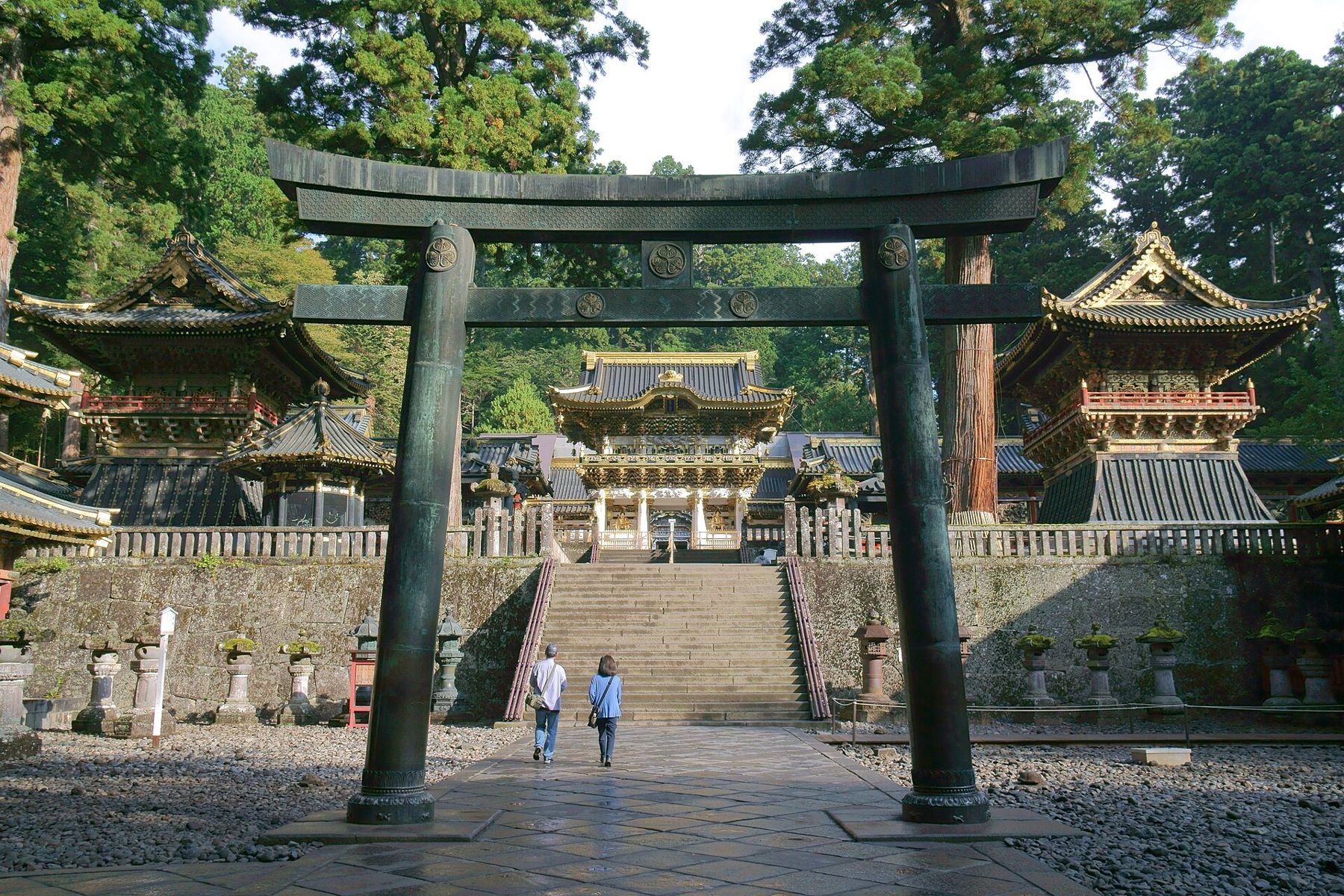
The shrines and temples of Nikko are a UNESCO World Heritage Site. The best known is Nikko Toshogu, the mausoleum of Tokugawa Ieyasu, founder of the shogunate that ruled Japan for more than two and a half centuries. Its buildings are covered in carving, lacquer and gold leaf, very different from the plain wood of most Shinto shrines. Beside it are Futarasan Shrine, dedicated to the gods of the local mountains, and the temple Rinnoji.
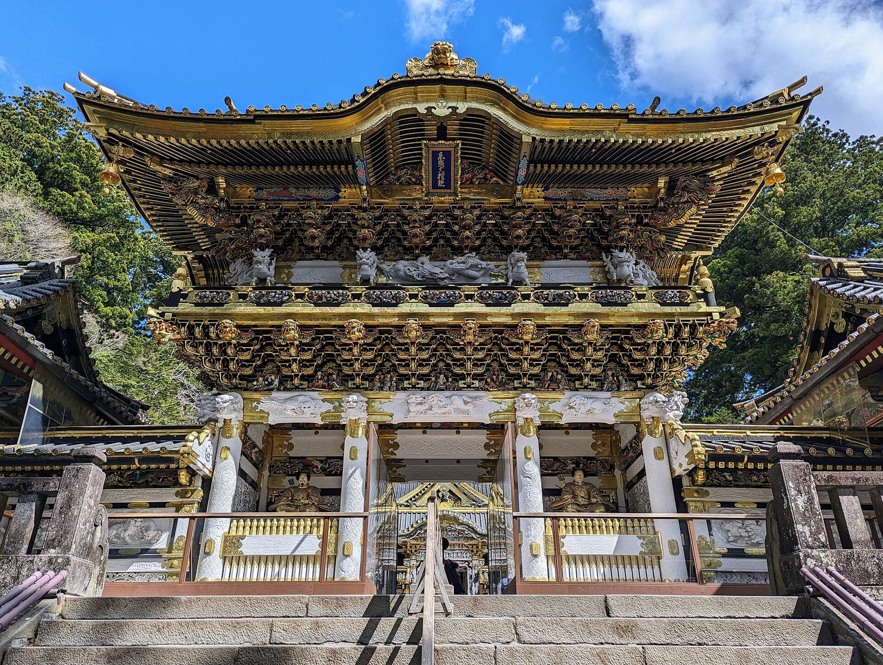
Go early in the morning, when the gates open and the tour groups have not yet arrived, and you will have the cedar avenues almost to yourself. Entry fees apply to the main buildings and change from time to time. Dress for walking on stone steps, and take your hat off inside the halls. At the bottom of the shrine area, the red Shinkyo bridge crosses the Daiya River; it marks the traditional entrance to the sacred area.
Lake Chuzenji and Kegon Falls
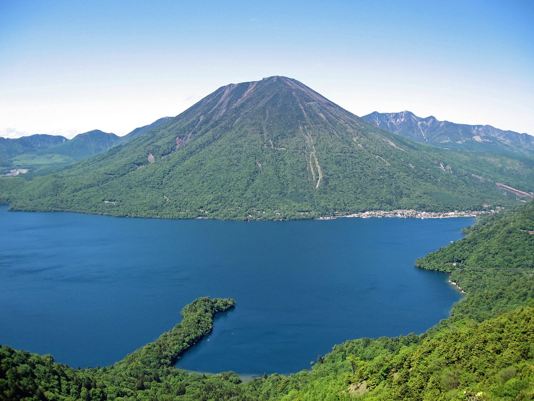
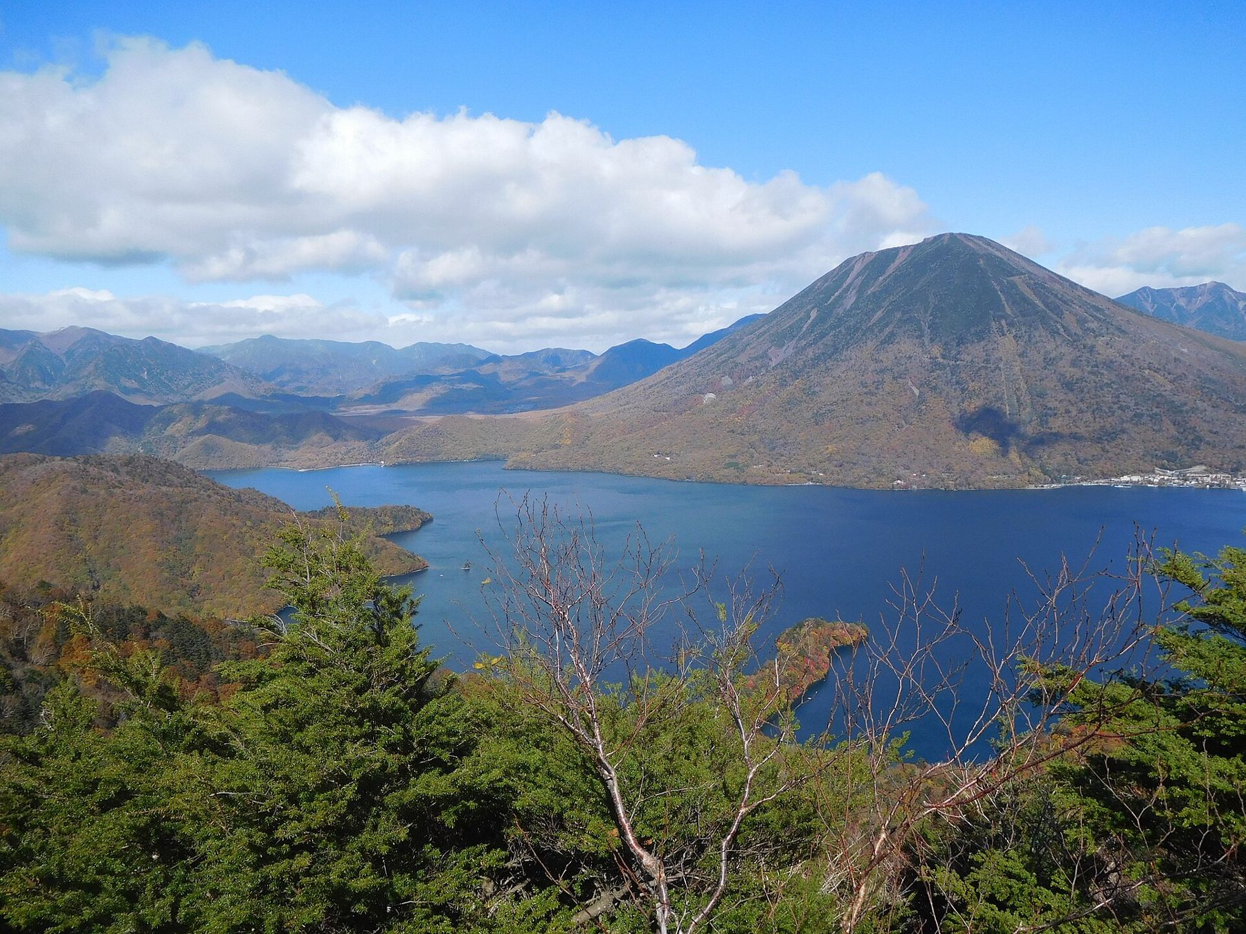
From the town, the Irohazaka road climbs to the high country in a long chain of hairpin bends, one road for going up and another for coming down. At the top lies Lake Chuzenji, a deep lake formed when lava from Mount Nantai blocked a valley. Nantai, a sacred mountain with a shrine at its summit, rises straight from the north shore. The lake sits at almost 1,300 metres, and its water stays cold all year.
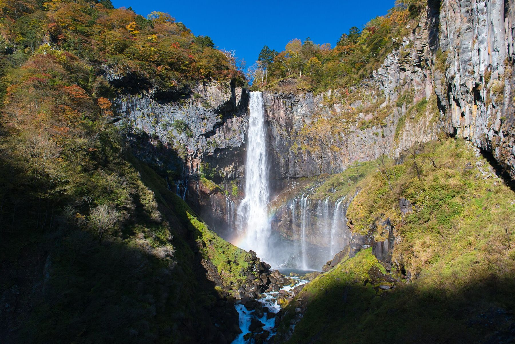
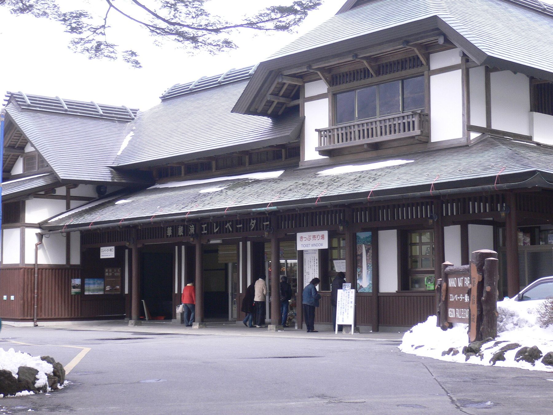
The lake drains over Kegon Falls, a nearly 100-metre drop into a rock gorge just east of the lake. An elevator takes you down to a viewing platform near the base for a fee. Kegon is one of the most famous waterfalls in Japan, and it is impressive in every season: in full flow after rain, framed in colour in autumn, and partly frozen in deep winter.
The shores of Chuzenji were once a summer retreat for foreign diplomats, and some of their old villas have been restored and opened to visitors. Walking trails follow parts of the shoreline, and sightseeing boats run on the lake in the warmer months.
 another page in the bookKamikochi and the Northern Alps
Senjogahara and Yumoto
West of the lake, the road climbs again to Senjogahara, a wide marsh plateau at about 1,400 metres. Boardwalks cross the wetland between grasses, sedges and stands of larch, with Nantai and the surrounding peaks around the edge. It is a gentle walk of a few hours, flat all the way, and in early summer the marsh is full of wildflowers and birdsong.
The marsh walk is flat, quiet and easy, and on a cool June morning it feels a long way from Tokyo.
The marsh walk is flat, quiet and easy, and on a cool June morning it feels a long way from Tokyo. The trail links waterfalls at both ends of the plateau. Ryuzu Falls, the "dragon's head", tumbles down a long rocky staircase near the lake, and Yudaki falls from Lake Yunoko at the top. A forest road from Akanuma, at the eastern edge of the marsh, to the far western shore of Lake Chuzenji is closed to private cars and served by a low-emission bus, which keeps that corner of the park quiet. The bus is a good way to reach the lake's western beaches, where there is little but water, forest and the view of the mountains.
Above Yudaki sits Lake Yunoko and the hot spring village of Nikko Yumoto, the end of the bus line. The water here smells of sulphur, and day-use baths make a good finish to a walk. A trail circles Yunoko in an hour or so.
Camping in Okunikko
The campgrounds of Okunikko are spread around Lake Chuzenji, the edge of Senjogahara and the Yumoto area. Some are on the lake shore, with pitches among the trees and the water a few steps away; others are tucked into the forest. Most open only from late spring to autumn. Facilities and rules differ, so check each one's season, booking method and fees directly, and look at our guide to campground types and rules if you are new to camping in Japan.
Nights at this altitude are cold, even in summer. In late May and October expect temperatures near freezing, and bring a sleeping bag to match. The rainy season brings grey, misty weeks in June and July, and summer afternoons often end with thunder. Pack a good rain shell and a tarp.
Asian black bears live throughout these mountains. Keep all food and rubbish in your car or a sealed container, use a bell on forest trails, and follow posted warnings. Wild Japanese macaques are common around the lake and the Irohazaka road, and they will take food from bags or open cars. Do not feed them. Deer are everywhere on the plateau and graze around the campgrounds at dusk.
Birdwatchers come to Senjogahara for the summer migrants that nest in the marsh and woods, and binoculars are worth the weight. Early morning is the best time, before the first buses arrive. Stay on the boardwalks: the marsh is fragile, and stepping off them damages plants that take years to recover. The same goes for the shore of Yunoko and the meadows around Yumoto. Pick nothing, feed nothing, and take every scrap of rubbish back to camp with you.
Autumn, crowds and getting there
Autumn is when Nikko gets truly busy. The autumn leaves start at the top, around Yumoto and Senjogahara, in late September or early October, then move down to the lake shore and the Irohazaka road by mid to late October, and to the town in early November. On peak weekends, the road up from town can back up for hours. Go on weekdays, start very early, or use the bus and avoid the drive entirely.
From Tokyo, private-railway express trains run from Asakusa to Tobu-Nikko, and JR trains reach JR Nikko via Utsunomiya, which is on the Tohoku Shinkansen. From either station, buses climb to Lake Chuzenji and on to Yumoto. They are frequent in season but slow in traffic, and timetables change, so check them before you set off. By car, the Nikko-Utsunomiya Road leads to the town, and Irohazaka takes you up. With a full kit on public transport, a campground near a bus stop on the lake road is the easiest choice.